Rongai Route 7-Day Kilimanjaro Climb
The Northern Route - Quietest route with excellent dry season conditions
Tour Overview
The Rongai Route is the only path approaching Mount Kilimanjaro from the north, near the Kenyan border. This remote route offers a completely different perspective of the mountain with significantly lower traffic and drier conditions than popular southern routes.
The northern side of Kilimanjaro receives less precipitation, making Rongai an excellent choice during the rainy season (March-May) when southern routes can be muddy and challenging. The trek begins through cultivated farmland before entering pine forest and eventually emerging into moorland with stunning views toward Kenya.
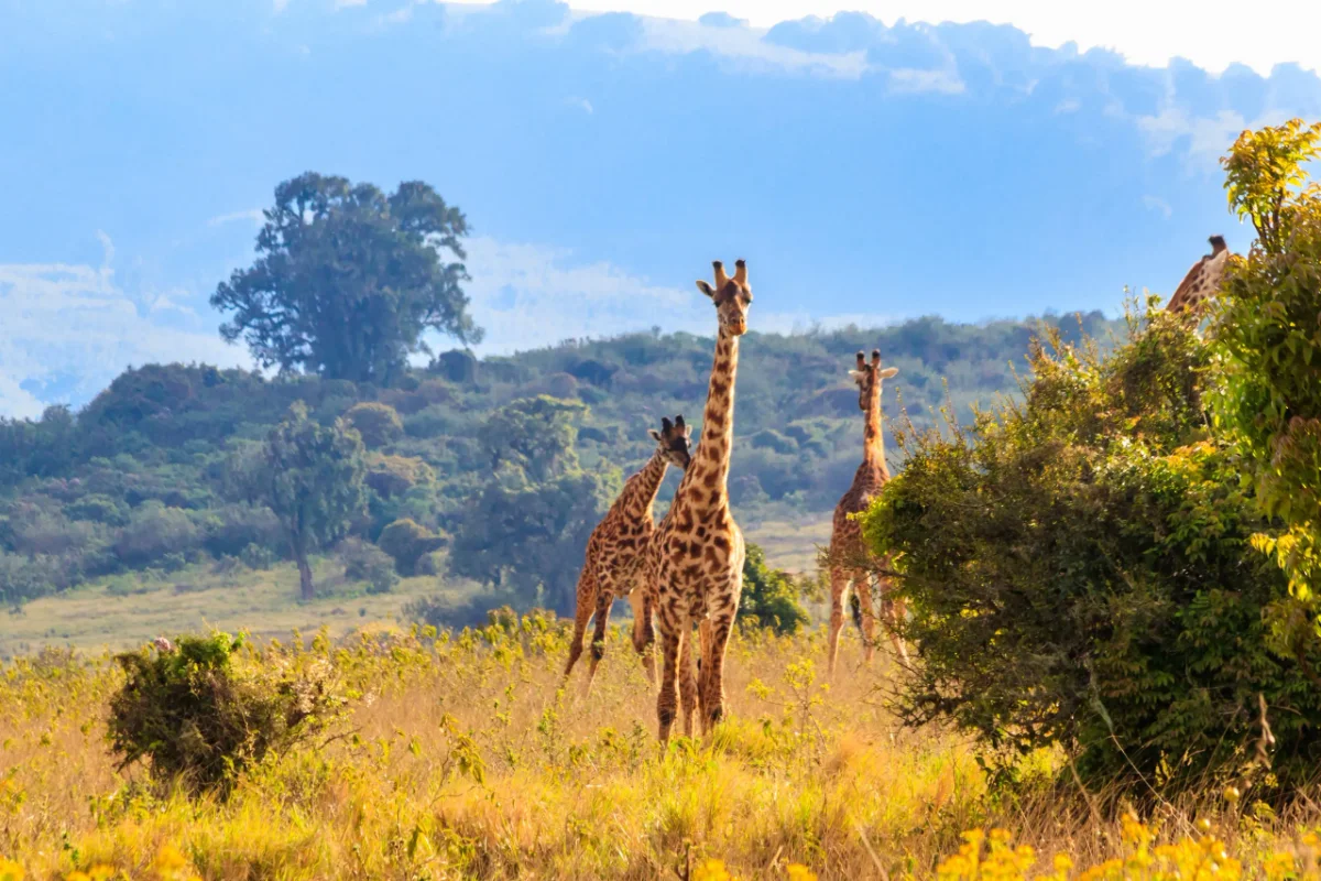
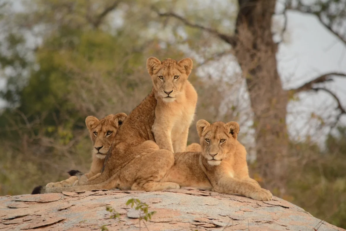
Rongai's gradual steady ascent profile makes it one of the easier routes physically, though it doesn't include the "climb high, sleep low" acclimatization of southern routes. The 7-day itinerary compensates with longer duration for gradual altitude gain. The route offers true wilderness experience with excellent chances of wildlife sightings in lower zones, including elephants and buffalo.
This route is ideal for those seeking solitude and pristine wilderness away from crowds. The northern approach provides unique perspective and reliable dry conditions. While scenery is less dramatic than Lemosho or Machame, the remote atmosphere, good 80% success rate, and uncrowded trails make Rongai excellent for those prioritizing peace and steady manageable ascent.
Tour Highlights
Your Journey
8 DaysArrival in Moshi - Pre-Trek Preparation
Arrive Kilimanjaro Airport and transfer to Moshi hotel. Meet your guide for detailed trek briefing covering the unique northern route approach, daily expectations, equipment requirements, and altitude strategies. Equipment check and rental arrangements. The Rongai Route's northern approach means less tourist traffic and drier conditions. Welcome dinner and rest before tomorrow's long drive to northern starting point.
Rongai Gate (1,950m) to Simba Camp (2,650m)
Long scenic drive to northern side of Kilimanjaro near Kenyan border (3-4 hours). At Rongai Gate, guides complete registration. Trail begins relatively flat through cultivated farmland with maize and potato fields before entering pine forest. This driest side of mountain - vegetation less lush than south. Gradual climb through forest with good chances spotting colobus monkeys, blue monkeys, various birds. Remote northern approach sees few trekkers - peaceful start. Emerge from forest onto moorland approaching Simba Camp (First Cave Camp). Views across Kenyan plains. Distance: 8km, Elevation gain: +700m. Hiking time: 4-5 hours.
Simba Camp (2,650m) to Second Cave Camp (3,450m)
Trail continues through moorland with heather and volcanic rock. Landscape open with expansive views toward Kenya and surrounding plains. Northern side drier and less vegetated than southern slopes - different atmosphere. Steady climb across ridges and through valleys with increasingly sparse vegetation. Wildlife sometimes spotted - including eland and elephants. Terrain relatively gradual compared to other routes - comfortable trekking day. Second Cave Camp sits in protected valley with stunning mountain views above. Simple camp well-positioned for acclimatization. Distance: 6km, Elevation gain: +800m. Hiking time: 3-4 hours.
Second Cave Camp (3,450m) to Kikelelwa Camp (3,600m)
Steady ascent through increasingly barren landscape entering alpine desert zone. Vegetation sparse with only hardy grasses and small shrubs at this altitude. Path crosses several ridges with spectacular panoramic views. Clear days reveal both Kibo and Mawenzi peaks towering above. Landscape has remote wild feeling with minimal signs of other climbers. Air noticeably thinner with altitude gain. Kikelelwa Camp (Third Cave Camp) sits sheltered location with stunning views of dramatic Mawenzi Peak to east. Camp provides good wind protection and excellent photo opportunities. Distance: 6km, Elevation gain: +150m. Hiking time: 3-4 hours.
Kikelelwa Camp (3,600m) to Mawenzi Tarn Camp (4,315m)
Spectacular day trekking toward dramatic spires of Mawenzi Peak. Trail climbs steadily through alpine desert with stunning views of jagged volcanic peaks ahead. Mawenzi is second-highest peak on Kilimanjaro at 5,149m with impressive rocky spires. Landscape barren and beautiful with volcanic rock formations and minimal vegetation. Cross lunar-like desert before arriving at Mawenzi Tarn Camp, spectacularly situated beneath towering Mawenzi cliffs. Small mountain lake (tarn) near camp when water sufficient. One of most scenic campsites on mountain. Afternoon acclimatization walk up Mawenzi lower slopes highly recommended. Distance: 5km, Elevation gain: +715m. Hiking time: 3-4 hours.
Mawenzi Tarn Camp (4,315m) to Kibo Hut (4,700m)
Cross vast saddle between Mawenzi and Kibo peaks - barren high-altitude desert over 4,000m. Section often called "lunar desert" for stark otherworldly appearance with virtually no vegetation and expansive volcanic rock fields. Trail relatively flat but altitude makes walking challenging. Pass junction with Marangu Route approaching Kibo Hut. Landscape desolate but beautiful in starkness. Kibo Hut sits at base of Kibo crater wall - base camp for summit attempt. Upon arrival, early dinner and rest before midnight start. Prepare all summit gear, fill water bottles, organize snacks for long summit night. Distance: 8km, Elevation gain: +385m. Hiking time: 5-6 hours.
Summit Day: Kibo Hut (4,700m) to Uhuru Peak (5,895m) to Horombo Hut (3,720m)
Wake before midnight for hot drinks and snacks. Begin steep ascent through loose volcanic scree toward Gilman's Point on crater rim. Climb slow and demanding with steep switchbacks in freezing temperatures and thin air. Most mentally and physically challenging section. Reaching Gilman's Point (5,681m) around sunrise incredibly emotional - you've reached crater rim! Those with energy continue 1-2 hours along rim to Uhuru Peak (5,895m) - highest point in Africa! Final section offers spectacular glacier and crater views. Summit photos and celebration, then long descent to Kibo Hut for rest and lunch. Continue descending to Horombo Hut on Marangu Route. Long tiring descent. Summit: 6-7 hours, Total: 12-15 hours. Distance: 21km, Elevation: +1,195m/-2,175m.
Horombo Hut (3,720m) to Marangu Gate (1,860m) - Victory Descent
Final day is long descent to Marangu Gate on southeastern side. Trek through moorland with giant heathers and open landscape, gradually entering montane rainforest zone. Forest lush and beautiful with moss-covered trees and abundant bird life. Trail passes Mandara Hut before continuing through dense rainforest to Marangu Gate. Forest trail can be slippery and muddy after rain - poles useful. As you descend, air thickens and warms, energy returns. At Marangu Gate, complete park formalities and receive summit certificate - gold for Uhuru Peak, green for Gilman's Point. Transfer back to hotel. Distance: 20km, Elevation loss: -1,860m. Hiking time: 6-7 hours.
What's Included
- All Kilimanjaro National Park fees
- Professional KPAP-registered guides
- Mountain crew including porters and cook
- 6 nights mountain camping accommodation
- Quality camping equipment and sleeping mats
- All meals on the mountain (B/L/D)
- Treated drinking water throughout
- Emergency oxygen and first aid kit
- Daily altitude monitoring
- Airport transfers and transportation
- 2 nights hotel accommodation
- Summit certificate presentation
- Flying Doctors evacuation insurance
Not Included
- International flights
- Tanzania visa ($50-$100)
- Travel and medical insurance (mandatory)
- Personal climbing gear (rental available)
- Sleeping bag rental ($30)
- Trekking poles rental ($15)
- Crew tips ($250-$300 suggested)
- Hotel meals and drinks
- Laundry and personal items
- Pre/post trek activities
Quick Enquiry
100% customizable tour
Related Tours
More adventures in Tanzania
Ready to Experience Rongai Route 7-Day Kilimanjaro Climb?
Contact us today to start planning your adventure. Our experts will help customize this tour to your preferences.